IEBC (Independent Electoral and Boundaries Commission) 'DATA'
My first post for 2016 'Happy Year',yeah someone hasn't be coding that much,with the Kenyan elections just around i decided to dig the web looking for election data and stumble upon the IEBC | Elections portal.
An API for Election data as needed i registered for the API but no reply ,wrote a couple of emails ,tweets still no reply 'but' i found a workaround the API works just fine with the sample token.
e.g
http://api.iebc.or.ke/constituency/?token=afd3877583a07e5b77e447332bb98a80 end point to all 290 consituency.
http://api.iebc.or.ke/ward/?token=afd3877583a07e5b77e447332bb98a80 end point to 1450 wards.
The boundaries are in geojson, i used this example at gis.stackexchange to convert geojson files to shapefiles,but my preferred file format was SVG,to convert the shapefiles to SVG i used ArcMap i had to add every shapefile individually time consuming process but was needed to confirm all constituencies and wards and then exported them to an SVG format.
Javafx supports SVG and the whole idea of treating a county or county assembly ward as an individual node made it more practical to use SVG.
for Counties and Constituencies i copied the d content of the SVG path how to do it in Inkscape and used the county/constitunecy names as Enum.
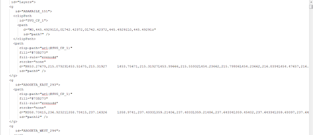
SVG file snapshot
Code sample
Results
All 290 constituency were accounted for but county assembly wards this 6 were missing :-
Name County Assembly Code
Riwo 641
Kasemeni 50
Elwak North 209
Embobut_embulot 734
Lelan 735
Ngei 1448
The IEBC doesn't have all election results for all wards but the endpoint looks like this
http://api.iebc.or.ke/results/ward/6C03B688-9D05-4592-A0B3-55B25BBFC05A/?post=4&election=GEK2013&token=afd3877583a07e5b77e447332bb98a80
Endpoint to SOUTH IMENTI county assembly ward results.Look below for the final result of the available county assembly ward results vizualisation.
All the SVG files can be found here
Results
Query counties with more than 5 constituencies.
Available results of county assembly wards
Still waiting for the complete results ,but they were some issues with the IEBC portal data like some party color string were wrong,
#fdcbo7 instead #fdcb07 had to create a ternary operator that looks like so
An API for Election data as needed i registered for the API but no reply ,wrote a couple of emails ,tweets still no reply 'but' i found a workaround the API works just fine with the sample token.
e.g
http://api.iebc.or.ke/constituency/?token=afd3877583a07e5b77e447332bb98a80 end point to all 290 consituency.
http://api.iebc.or.ke/ward/?token=afd3877583a07e5b77e447332bb98a80 end point to 1450 wards.
The boundaries are in geojson, i used this example at gis.stackexchange to convert geojson files to shapefiles,but my preferred file format was SVG,to convert the shapefiles to SVG i used ArcMap i had to add every shapefile individually time consuming process but was needed to confirm all constituencies and wards and then exported them to an SVG format.
Javafx supports SVG and the whole idea of treating a county or county assembly ward as an individual node made it more practical to use SVG.
for Counties and Constituencies i copied the d content of the SVG path how to do it in Inkscape and used the county/constitunecy names as Enum.
public enum Constituency {

   MANDERA_SOUTH("path content");

   private final String path;

    Constituency(String path){
        this.path=path;
    }

}
for county assembly wards 1450 wards i could not simply copy all the contents so i decided to parse the SVG file using the Jsoup library. this a snapshot of my wards SVG file.
SVG file snapshot
 |
| CAW.svg |
      Group root=new Group();

        File input = new File("CAW.svg");

        Document doc = Jsoup.parse(input, "UTF-8", "http://example.com/");

        Elements content = doc.getElementsByTag("g");

        for(Element el:content){

            Elements path=el.getElementsByAttributeValueMatching("id","\\w{1,}[_]\\d{1,}");

            Elements path_clip= el.getElementsByAttribute("clip-path");

            for(Element _el:path_clip){

                SVGPath svg=new SVGPath();
                svg.setContent(_el.attr("d"));
                root.getChildren().add(svg);
          }

        }
Results
 |
| Kenya County Assembly Wards |
All 290 constituency were accounted for but county assembly wards this 6 were missing :-
Name County Assembly Code
Riwo 641
Kasemeni 50
Elwak North 209
Embobut_embulot 734
Lelan 735
Ngei 1448
The IEBC doesn't have all election results for all wards but the endpoint looks like this
http://api.iebc.or.ke/results/ward/6C03B688-9D05-4592-A0B3-55B25BBFC05A/?post=4&election=GEK2013&token=afd3877583a07e5b77e447332bb98a80
Endpoint to SOUTH IMENTI county assembly ward results.Look below for the final result of the available county assembly ward results vizualisation.
All the SVG files can be found here
Results
 |
| 2013 General Election Presidential result by county color coded by party |
Query counties with more than 5 constituencies.
 |
| counties with more than 5 constituencies. |
 |
| 900+ results CAW color coded by party |
Still waiting for the complete results ,but they were some issues with the IEBC portal data like some party color string were wrong,
#fdcbo7 instead #fdcb07 had to create a ternary operator that looks like so
String color=party.getColor().equals("#fdcbo7") ? "#fdcb07" : party.getColor();
Its good effort that IEBC is making available this kind of data to the public.
Good piece of info. However I would like to implement this API in a web platform that runs on Java: i.e jsp. How would I go about it?
ReplyDeleteYou can try a java applet.
DeleteYou can as well use QGIS to convert geojson to shapefile or SVG formats. Check qgis.org. At the same time you can use the new kid on the block, LeafletJS to do the styling and displaying your map as a web map. All these are OpenSource software/library
ReplyDeleteHi, I have been trying to find those exact maps of Kenya by constituencies and by wards, but the IEBC never ever replies to any emails. Unfortunately, the API links described in your post are now dead. Would you happen to still have the data to perhaps share?
ReplyDeleteThank You and I have a swell proposal: How Long Renovate House home addition contractors
ReplyDelete